Yufudake
Yufudake Movies
![[大分県 湯布院] 博多からバスの旅 金鱗湖 由布岳](https://i.ytimg.com/vi/6TDLhJsQS-M/mqdefault.jpg)
![[遠隔参拝]大分県湯布院の3社巡り、由布岳の女神である宇奈岐日女神の社宇奈岐日女神神社、天然記念物の大杉パワースポットの大杵社、名所金鱗湖に佇む天祖神社](https://i.ytimg.com/vi/2ZZbN_g4f7A/mqdefault.jpg)


Basic Information
- Spot Name
- Yufudake
- Location
- 〒879-5102 Yufuin-cho Kawakami, Yufu City, Oita Prefecture
- Access
- From JR Yufuin Station on the Kyudai Line, take the Kamenoi Bus bound for Beppu Station for 15 minutes and get off at Yufu Trailhead. It takes about 2 hours on foot to reach the summit. It takes approximately 20 minutes by car from the Yufuin IC on the Oita Expressway to the main trailhead.
- Parking
- Parking available.
- Business Hours
- Open for visits.
- Contact Information
- Phone Number:0977-84-2446
- Official Website
Map
Detailed Information
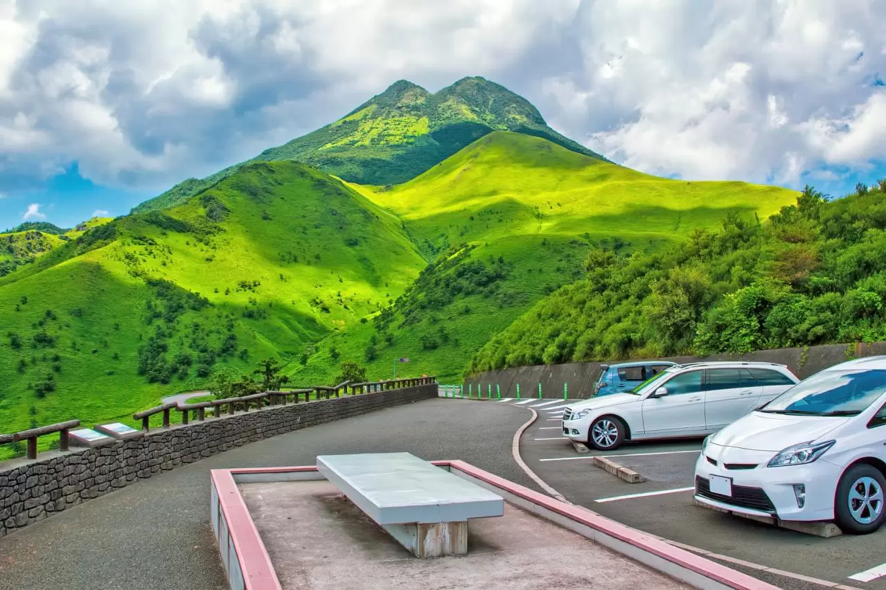
Mount Yufu is a 1,583-meter-high mountain rising on the border between Yufu City and Beppu City in Oita Prefecture. Located on the northeastern side of the Yufuin Basin, it is known as a beautiful twin-peaked mountain with two summits, the East Peak and West Peak. Because of its two side-by-side summits and well-proportioned form, which spreads broadly toward the foothills, it is also called the “Mount Fuji of Bungo.” As a symbolic presence of Yufuin, it is widely cherished by local residents and visitors alike.
Seen from in front of JR Yufuin Station or from the rural areas of the Yufuin Basin, Mount Yufu rises majestically, seemingly watching over the town. From the expressway as it approaches Yufu City, the mountain comes into view with an imposing presence, appearing almost to block the road ahead. On the journey from Beppu to Yufuin along the Yamanami Highway, visitors can also enjoy magnificent scenery formed by forests, grasslands, and mountain slopes.
Mount Yufu was formed through volcanic activity. Although the Japan Meteorological Agency classifies it as an active volcano, it is not designated as a volcano subject to continuous monitoring. The volcanic body consists of basal lava, several lava domes, summit lava, and other formations, and its most recent eruption is believed to have occurred approximately 2,000 years ago. When hiking, it is advisable to check volcanic information issued by the Japan Meteorological Agency and local authorities, in addition to ordinary mountain weather conditions, just to be safe.
Mount Yufu has been revered as a sacred mountain since ancient times. It is known as a celebrated peak that appears in the “Bungo Province Gazetteer,” compiled in the early Nara period, as well as in the “Manyoshu,” Japan’s oldest anthology of poetry. Throughout its long history, the mountain has been closely connected with the faith and daily lives of the people. Even today, shrines and temples associated with the mountain worship of Mount Yufu remain around Yufuin.
In the 2005 NHK morning television drama series “Kaze no Haruka,” Mount Yufu appeared repeatedly as a symbol of Yufuin, where the story was set. The mountain’s majestic form was broadcast nationwide, helping to make the landscapes of Mount Yufu and Yufuin widely known. Today, it is not only a representative mountain in the scenery of this hot-spring resort but also a popular destination visited by hikers from Japan and abroad.
One of Mount Yufu’s greatest attractions is the way its appearance changes dramatically with the seasons. At the foot of the mountain, controlled burning is carried out every year in early spring, depending on weather conditions, to preserve the grassland landscape. Immediately afterward, the mountainside temporarily turns black, but as spring progresses, new grass begins to sprout and gradually changes the slopes to a vivid young green.
From spring through early summer, visitors can enjoy the striking contrast between the young green slopes and the blue sky. At higher elevations, Miyamakirishima azaleas bloom in early summer, adding pink color to the trails and mountainsides. Miyamakirishima is one of the plants representative of Kyushu’s volcanic highlands, and many hikers visit during its blooming season. However, the flowering period and condition of the blossoms vary depending on temperatures and weather conditions each year.
In summer, the entire mountain is covered in deep green, displaying a powerful and vibrant appearance. The higher elevations may feel cooler than the urban areas, but some sections of the trail are exposed to direct sunlight. To prevent heatstroke, it is important to carry plenty of drinking water, prepare a hat and sunscreen, and hike at a comfortable pace without overexerting yourself.
In autumn, the trees on the mountainside turn red and yellow. The official information provided by Aso-Kuju National Park also introduces Mount Yufu as a mountain whose middle slopes are colored by autumn foliage. Pampas grass spreads across the foothills, and its silvery plumes swaying in the wind create a strongly seasonal landscape together with the autumn leaves. In the evening, the pampas grass and grasslands glow golden in the sunlight, offering a calm beauty different from that of spring and summer.
In winter, the grass withers and the foothills turn golden, while the area near the summits becomes white when snow falls. When conditions such as temperature and humidity are right, frost-covered trees and rocks known as juhyo-like rime, or “muhyo,” may appear as droplets of mist freeze onto their surfaces. Rime sparkling white beneath a blue sky is beautiful, but winter mountains become considerably more dangerous because of snow, ice, and strong winds. Depending on trail conditions, winter equipment such as crampons may be necessary. It is important to check the snow conditions in advance and climb only with sufficient experience and appropriate equipment.
Mount Yufu has several hiking routes, but the most common is the course starting from the Yufu-dake Front Trailhead along the Yamanami Highway. From the front trailhead, the route crosses grasslands and passes through a forested area before reaching Goyagoe. From there, hikers gain elevation while zigzagging up the slope toward Matae, the point where the trails to the East Peak and West Peak divide.
At Matae, the trail splits toward the East Peak and West Peak. The route to the East Peak is generally considered less difficult than the route to the West Peak, but steep slopes and rocky sections near the summit require great caution. The route to the West Peak includes chain sections and rugged rock faces, where there is a risk of falling. Hikers with limited experience or those who are uncomfortable with heights should not force themselves to aim for the West Peak. Rock sections become particularly dangerous in rainy or windy conditions, so depending on the circumstances, it may be necessary to turn back from Matae.
There is also a route called the “Ohachi Meguri,” which circles the crater rim between the East and West Peaks. However, this is a challenging route that includes rocky areas and other dangerous sections. It requires sufficient hiking experience, appropriate equipment, and stable weather, and is not a casual walking path suitable for ordinary tourists.
Those with limited hiking experience should not force themselves to complete the Ohachi Meguri or climb the West Peak. Instead, they should consider making a round trip to the East Peak after taking the weather and their physical condition into account. Even the East Peak has rocky areas and steep slopes near the summit, so hikers must be properly equipped with hiking boots, rain gear, and other essentials, and proceed with caution.
A round trip from the front trailhead to the summit generally takes about four to five hours. However, the time can vary considerably depending on walking speed, rest periods, time spent at the summit, weather, and which peak is climbed. Reaching the West Peak or completing the Ohachi Meguri requires additional time. Beginners and those who wish to enjoy taking photographs should make a plan with plenty of extra time and start early enough to ensure that they can descend before sunset.
The front trailhead has a parking lot and a “Yufu Tozanguchi” bus stop. According to official tourism information from Oita Prefecture, the trailhead is approximately 15 minutes by bus from JR Yufuin Station and about 20 minutes by car from the Yufuin Interchange on the Oita Expressway. However, bus frequency and schedules may change, so it is advisable to check the latest timetable before traveling.
The area around the front trailhead may become crowded on holidays during the hiking season and on the day of the annual mountain-opening ceremony. There are also no restrooms along the trail, so hikers should use the facilities at the trailhead before setting out. Since drinking water and food cannot necessarily be replenished along the route, prepare sufficient water, trail snacks, rain gear, warm clothing, a map, a mobile phone, a portable battery, and other necessary items in advance.
Mountain weather can change quickly. Even when the foothills are sunny, the area near the summit may be affected by fog, strong winds, or rain. Before setting out, check the weather forecast and submit a hiking notification. It is also reassuring to tell family members or friends your planned route and expected return time.
Whenever possible, hike with several people. If hiking alone, an especially careful plan is necessary. If you have concerns about your physical condition or the weather, it is important to turn back early rather than insist on reaching the summit. Conditions in nature do not always proceed as planned, and avoiding unnecessary risks is the key to safe hiking.
From near the summit, hikers can look out over the Yufuin Basin, the town of Yufuin, Beppu Bay, Mount Tsurumi, and the Kuju Mountain Range. On clear days, the view extends to distant mountains, offering a magnificent panorama unique to a 1,583-meter-high peak. Looking down at the route you have climbed and the rural landscape below gives you a real sense of the scale of Mount Yufu and the terrain of the Yufuin Basin.
When weather conditions are right, the Brocken specter may also be visible near the summit. This phenomenon occurs when, with the sun behind you, your shadow is cast large upon fog or clouds ahead, surrounded by a ring of rainbow-colored light. It occurs only when the positions of the sun, observer, and fog or clouds align appropriately, so it cannot be seen at any time. Encountering it by chance can become one of the most unforgettable sights of a Mount Yufu hike.
For those who prefer to admire Mount Yufu without climbing it, Sagiridai along the Yamanami Highway is highly recommended. From Sagiridai, visitors can look out over the Yufuin Basin and the surrounding mountains while enjoying magnificent scenery during a drive. On clear days and around sunset, the mountains and Yufuin Basin change impressively as they reflect the light. In some areas, visitors can also appreciate the powerful form of Mount Yufu rising close by.
Jakoshi Observation Point is another well-known viewpoint overlooking the Yufuin Basin and Mount Yufu. On chilly early mornings from autumn through winter, morning mist may cover the basin, creating a fantastic landscape in which Mount Yufu rises beyond the fog. However, morning mist depends on weather conditions such as temperature, humidity, and wind, so it is not guaranteed to appear. When visiting by car early in the morning or during winter, visitors should also be cautious of icy roads and poor visibility.
At Mount Yufu, an annual mountain-opening ceremony is held around May at the front trailhead to pray for the safety of hikers. A safety prayer ceremony and the distribution of commemorative gifts may be included, but the date and program vary from year to year. Those wishing to participate should check the latest information from Yufu City in advance.
One of the pleasures unique to Mount Yufu is the possibility of visiting Yufuin Onsen after finishing a hike. Relaxing in a hot spring while looking at the mountain you have just climbed allows you to soothe your tired body as you reflect on the journey. Even without hiking, visitors can admire Mount Yufu from many locations, including the rural areas around Yufuin Station, Sagiridai, and Jakoshi Observation Point.
Mount Yufu is a celebrated peak that combines beautiful twin summits, volcanic terrain, a tradition of mountain worship passed down since ancient times, nature in every season, and spectacular views from the summit. Its appeal can be fully appreciated not only by climbing it but also by viewing it from the town, observation points, or hot springs. When visiting Yufuin, be sure to enjoy the “Mount Fuji of Bungo” from a variety of locations as its appearance changes with the season and time of day.
Oita Tourist Attractions
View List
Oita Marine Palace Aquarium "Umitemago"
Oita Marine Palace Aquarium "Umitamago," located midway between Oita City and Beppu City, is a modern aquarium set against the stunning backdrop of Beppu Bay. The tw...
Takasaki Mountain Natural Zoo
Located at the foot of Mount Takasaki, which stands at an elevation of 628 meters between Oita City and Beppu City, Takasaki Monkey Park is one of Japan's premier na...
Kyushu Natural Animal Park African Safari
Kyushu Natural Animal Park African Safari is the only safari park in Kyushu, spread across a vast grassland of 1.15 million square meters. Here, wildlife lives freel...
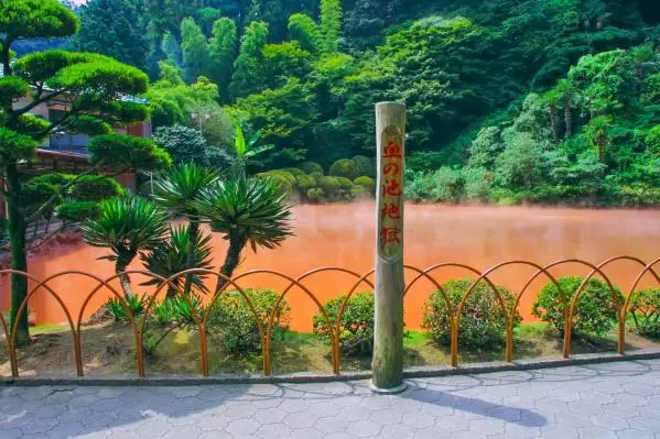
Beppu Jigoku Meguri (Hell Tour)
Beppu Jigoku Meguri is an attractive spot where visitors can closely observe the natural hot springs in Beppu Onsen, Oita Prefecture. Here, hot water and steaming mu...
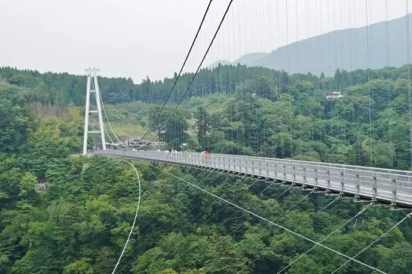
Kokono'e "Yume" Ootsurihashi
The Kuju "Dream" Suspension Bridge, located in Kuju Town, Oita Prefecture, boasts the highest walkway-only suspension bridge in Japan. With an elevation of 777 meter...
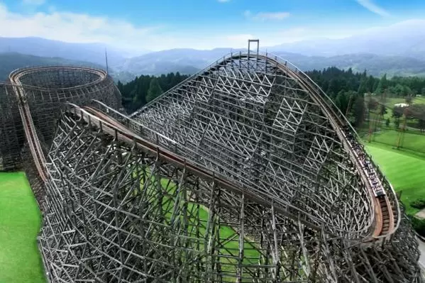
Kijima Kogen Park
Joujima Kogen Park is a resort spot located near the boundary of Beppu City and Yufu City in Oita Prefecture. It features Japan's first wooden roller coaster, "Jupit...
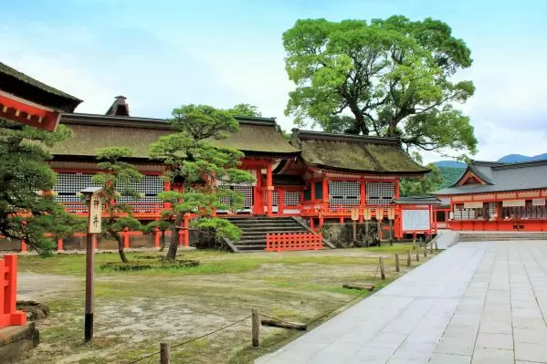
Usajingu Shrine
Usa Jingu is a famous shrine recognized as the head shrine of the approximately 40,000 Hachiman shrines across Japan. It was founded in 725 when the main hall dedica...